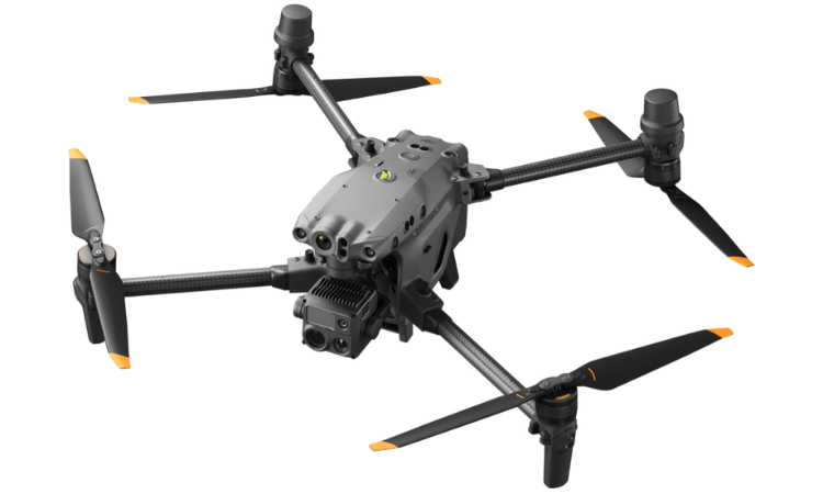
Compact and Portable
Foldable for easy storage
Termal Imaging Camera
Equivalent Focal Length: 40 mm Measuring accuracy: ±2°C or ±2%4
Wide Camera
Equivalent Focal Length: 24 mm DFOV: 84° 12 MP 1/2'' CMOS Sensor Video Resolution: 4K/30fps
Precise Positioning
RTK Positioning Accuracy (fixed RTK enabled) 1 cm+1 ppm (horizontal) 1.5 cm+1 ppm (vertical)
Safe and Stable
Dual-vision and ToF sensors appear on all six sides of the aircraft.
Infrared Sensing Systems
Obstacle Sensing Range From 0.1 to 10 m And FOV: 30°

Capture Everything
Unique aerial Intelligence to capture everything.
Advanced features unique and powerful tool for aerial intelligence gathering.
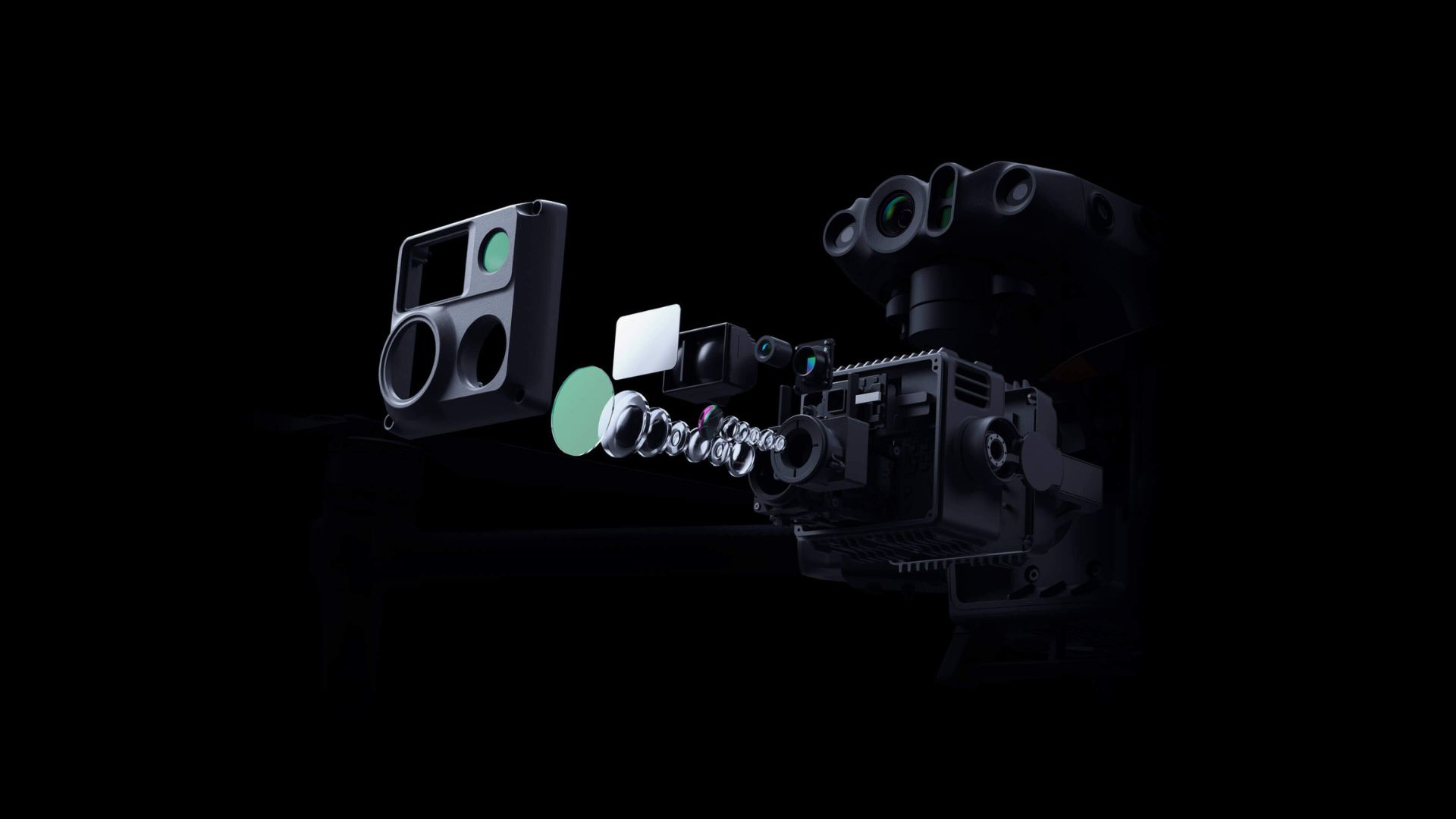
The Matrice 30T is a cutting-edge aerial intelligence platform designed to capture every detail with precision. Equipped with a wide camera, zoom camera, thermal imaging camera, and laser rangefinder, it offers unparalleled capabilities for various applications.
Safety
Advanced and Accurate Vision
The Matrice 30T prioritizes safety with dual-vision and Time-of-Flight (ToF) sensors strategically placed on all six sides of the aircraft. A built-in ADS-B receiver further enhances safety measures by providing real-time alerts and warnings about nearby crewed aircraft.
High Imaging System
Superior Image Quality Everywhere
The Matrice 30T excels in delivering high resolution and superior image quality across all environments. With its advanced imaging capabilities and state-of-the-art technology, this aerial platform ensures that every detail is captured with exceptional clarity.
DJI Dock
Operate in all conditions anywhere
DJI Docks are designed to be rugged and dependable, capable of operating continuously, regardless of the time of day or weather conditions. These robust docking stations provide a secure location for the Matrice 30 drone to land, recharge its batteries, take off, and perform missions that have been pre-programmed in DJI FlightHub 2. With the DJI Dock, the Matrice 30 can seamlessly carry out its tasks, ensuring uninterrupted operations and efficient execution of aerial missions.
Laser Range Finder
Pinpoint objects in distance with greater accuracy
The Matrice 30T is equipped with an advanced rangefinder that enhances its capabilities and precision. With the rangefinder technology, the drone can accurately measure distances, ensuring precise positioning and obstacle detection. This feature allows for safer and more efficient flight operations, as it enables the drone to navigate complex environments with increased accuracy and awareness.
Infrared Display
Discover Hotspots and Heat Signatures
The Matrice 30T comes equipped with high-resolution infrared (IR) technology, enabling the detection of hotspots and heat signatures. This advanced thermal capability allows the drone to identify and locate areas of elevated temperature, making it an invaluable tool for a variety of applications.

Environmental Adaptability
DJI Matrice 30T Resilience in Harsh Environments
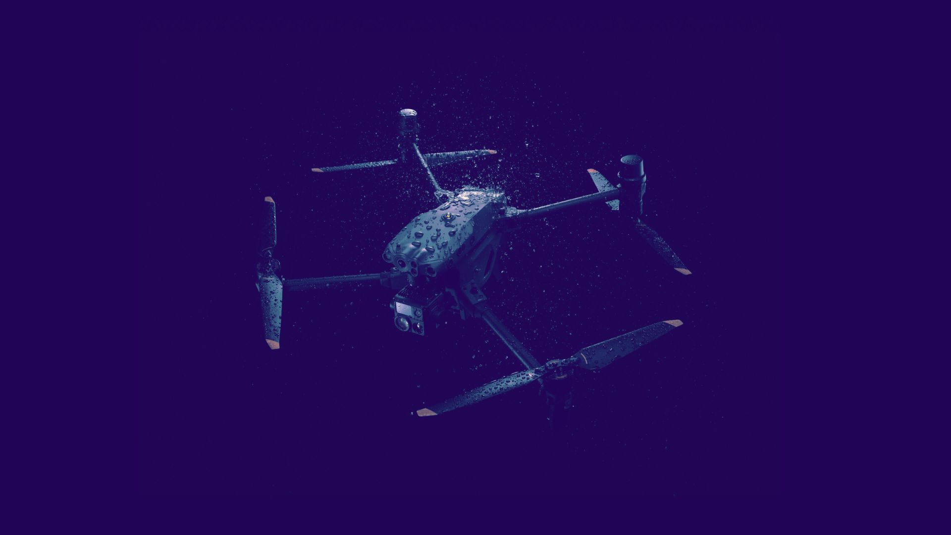
The DJI Matrice 30T showcases remarkable environmental adaptability, effortlessly navigating diverse and challenging conditions with ease and precision. Equipped with state-of-the-art technology and robust construction, the DJI Matrice 30T is designed to thrive in various environmental scenarios. Whether it's battling strong winds, enduring extreme temperatures, or braving unpredictable weather conditions, this drone excels in maintaining stability and delivering reliable performance.
DJI MATRICE 30T Packages
Everything you need to be airborne today!
- 1 Drone
- 1 Charger
- 1 Landing Pad
- 1 Spotlight
- 6 Batteries
DJI Matrice 30T Specifications
Aircraft Specs
| Dimensions (unfolded, excl. propellers) | 18.5 x 23.0 x 8.5 inches (L x W x H) |
|---|---|
| Dimensions (folded) | 14.4 x 8.5 x 7.7 inches (L x W x H) |
| Diagonal Wheelbase | 26.3 inches |
| Weight (incl. two batteries) | 8.3 ± 0.02 pounds |
| Max Takeoff Weight | 8.98 pounds |
| Max Takeoff Weight for C2 Certification in EU | 8.81 pounds |
| Operation Frequency[1] | 2.4000-2.4835 GHz; 5.725-5.850 GHz |
| Transmitter Power (EIRP) | 2.4 GHz: <33 dBm (FCC); <20 dBm (CE/SRRC/MIC) 5.8 GHz: <33 dBm (FCC/SRRC); <14 dBm (CE) |
| Hovering Accuracy (windless or breezy) | Vertical: ±0.33 feet (Vision System enabled); ±1.64 feet (N-mode with GPS); ±0.33 feet (RTK) Horizontal: ±0.98 feet (Vision System enabled); ±4.92 feet (N-mode with GPS); ±0.33 feet (RTK) |
| RTK Positioning Accuracy (fixed RTK enabled) | 0.39 inches + 0.0001 ppm (horizontal) 0.59 inches + 0.0001 ppm (vertical) |
| Max Angular Velocity | Pitch: 150°/sec.; Yaw: 100°/sec. |
| Max Tilt Angle | 35° (N-mode and Forward Vision System enabled: 25°) |
| Max Ascent/Descent Speed | 19.7 ft/s, 16.4 ft/s |
| Max Tilt Descent Speed | 22.97 ft/s |
| Max Horizontal Speed | 50.9 ft/s |
| Max Service Ceiling Above Sea Level (without other payload) | 16,404 feet (with 1671 propellers) 22,966 feet (with 1676 propellers) |
| Max Wind Resistance | 26.8 ft/s |
| Max Hover Time [2] | 36 minutes |
| Max Flight Time[2] | 41 minutes |
| Motor Model | 3511 |
| Propeller Model | 1671 |
| 1676 High Altitude (not included) | |
| Ingress Protection Rating[3] | IP55 |
| GNSS | GPS+Galileo+BeiDou+GLONASS (GLONASS is supported only when RTK module is enabled) |
| Operating Temperature | -4° to 122° F |
Wide Camera Specs
| Sensor | 1/2" CMOS |
|---|---|
| Effective Pixels | 12 million |
| Lens DFOV | 84° |
| Focal Length | 4.5 mm (equivalent: 24 mm) |
| Aperture | f/2.8 |
| Focus | 1 m to ∞ |
| Exposure Compensation | ±3 ev (using 1/3 ev as step length) |
| Electronic Shutter Speed (Auto Mode) |
Photo: 1/8000-1/2 seconds Video: 1/8000-1/30 seconds |
| Electronic Shutter Speed (M Mode) |
Photo: 1/8000-8 seconds Video: 1/8000-1/30 seconds |
| ISO Range | 100-25600 |
| Max. Video Resolution | 3840×2160 |
| Photo Size | 4000×3000 |
Thermal Camera Specs
| Thermal Imager | Uncooled VOx Microbolometer |
|---|---|
| Lens DFOV | 61° |
| Focal Length | 9.1 mm (equivalent: 40 mm) |
| Aperture | f/1.0 |
| Focus | 5 m to ∞ |
| Sensitivity | ≤30 mk@F1.1 |
| Infrared Temperature Measurement Accuracy | ±2°C or ±2% (using the larger value) |
| Video Resolution |
Infrared Image Super-resolution Mode: 1280×1024 Normal Mode: 640×512 |
| Photo Size |
Infrared Image Super-resolution Mode: 1280×1024 Normal Mode: 640×512 |
| Pixel Pitch | 12 um |
| Temperature Measurement Method | Spot Meter, Area Measurement |
| Temperature Measurement Range |
High Gain Mode: -20° to 150° C (-4° to 302° F) Low Gain Mode: 0° to 500° C (32° to 932° F) |
| Temperature Alert | Supported |
| Palette |
White Hot/Black Hot/Tint/Iron Red/Hot Iron/Arctic/Medical/Fulgurite/Rainbow 1/Rainbow 2 |
Speaker Specs
| Sensor | 1/2" CMOS, Effective pixels: 48M |
|---|---|
| Lens Focal Length | 21-75 mm (equivalent: 113-405 mm) |
| Aperture | f/2.8-f/4.2 |
| Focus | 5 m to ∞ |
| Exposure Compensation | ±3 ev (using 1/3 ev as step length) |
| Electronic Shutter Speed |
Auto Mode: Photo: 1/8000-1/2 s Video: 1/8000-1/30 s |
| M Mode Shutter Speed |
Photo: 1/8000-8 s Video: 1/8000-1/30 s |
| ISO Range | 100-25600 |
| Max. Video Resolution | 3840×2160 |
| Max Photo Size | 8000×6000 |
Charger Specs
| Obstacle Sensing Range |
Forward: 2-125 ft Upward/Downward/Backward/Sideward: 1.6-108 ft |
|---|---|
| Field of View (FOV) |
Horizontal: 65° Vertical: 50° |
| Operating Environment | Surfaces with clear patterns and adequate lighting (> 15 lux) |
Sensing Specs
| Wavelength | 905 nm |
|---|---|
| Max Laser Power | 3.5 mW |
| Single Pulse Width | 6 ns |
| Measurement Accuracy | ± (0.2 m + D×0.15%) |
| Measuring Range | 3-1,200 m (0.5×12 m vertical surface with 20% reflectivity) |
Battery Specs
| Obstacle Sensing Range | 0.33 to 32.81 ft |
|---|---|
| FOV | 30° |
| Operating Environment | Large, diffuse, and reflective obstacles (reflectivity >10%) |


Midwest Air
Proudly servicing Ohio and the Midwest regions
